Have you ever wondered how to get free satellite imagery of any location on Earth? In this blog I’ll share some of the top sources of satellite imagery for 2026.
I’ve been working with satellite imagery for the past 7 years and after spending hours, days, weeks and longer working through salespeople just to get a single image, I put together this blog to show you how to do it for free! It’s becoming easier, and cheaper than ever for anyone to access satellite imagery from anywhere, and any device. Even from your phone!
We live in a world that’s constantly changing, and one of the best ways to monitor and analyse that change is by using satellite imagery. But not everyone can afford to pay for high resolution satellite images. So, in this blog I’m going to share some free resources that you can use to access satellite imagery as easily as possible.
Google Earth Pro
Google Earth Pro is like Google Earth, but more, well, pro. And still completely free! It features many extra tools, but also in my opinion, a smoother experience. One of the best features that Google Earth Pro has is the ability to download a high quality image of the location you’re looking at. Let’s say you’re making a presentation and want to use an image from Google Earth. You take a screenshot from your browser but it just looks… not great…
To download a high resolution image in Google Earth Pro you can head up to the toolbar and select ‘Save Image’. This will open up an interface which allows you to customise the image that you will save. You can select options such as a title & description for your map, a legend, a north arrow, or you can remove all of these. You also have the ability to select the resolution of the image that you’d like to export. Once you’re happy with the settings you can click ‘Save Image’ and you’ll have your chosen image saved to your computer

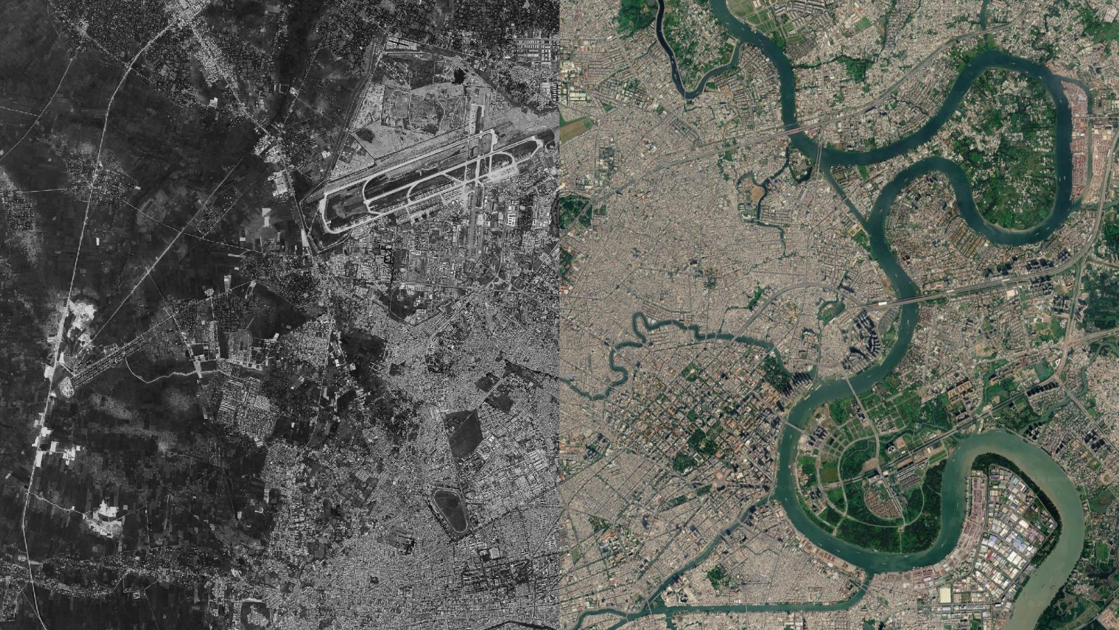
Another great feature that relates to this is the ability to view historic imagery. The amount of historic imagery available depends on the area you’re looking at, but some locations have aerial imagery from the 1950s, and dozens of images up until currents times. Some locations will have images only a few months old and can be incredibly useful of analysis.
In addition to this, Google Earth Pro also allows you to add pins, polygons, lines and more to the map. You can save these for future reference, add them to folders, and even add detailed descriptions with links and images. This is incredibly useful if you’re working on a mapping project.
ESRI World Imagery Wayback
Perhaps you want something similar to the historic imagery that Google Earth Pro has but more browser based… the ESRI World Imagery Wayback is a browser based archive that allows users to explore and compare historic ESRI satellite data. While the archive isn’t quite as extensive as Google’s, it’s definitely an option worth exploring if you’re looking for something specific and maybe isn’t available on Google Earth.

This option also has some unique features such the ‘Swipe Mode’ tool which allows you to compare imagery of a certain area. This is great for looking at before & after imagery following certain events or changes. Then there’s the ‘Animate’ mode which create a timelapse of the images over your area. You can even download the animation as a GIF! This makes it super easy to share pretty much anywhere online.
Overall it’s a great resource if you’re looking for another way to explore your location of interest.
USGS EarthExplorer
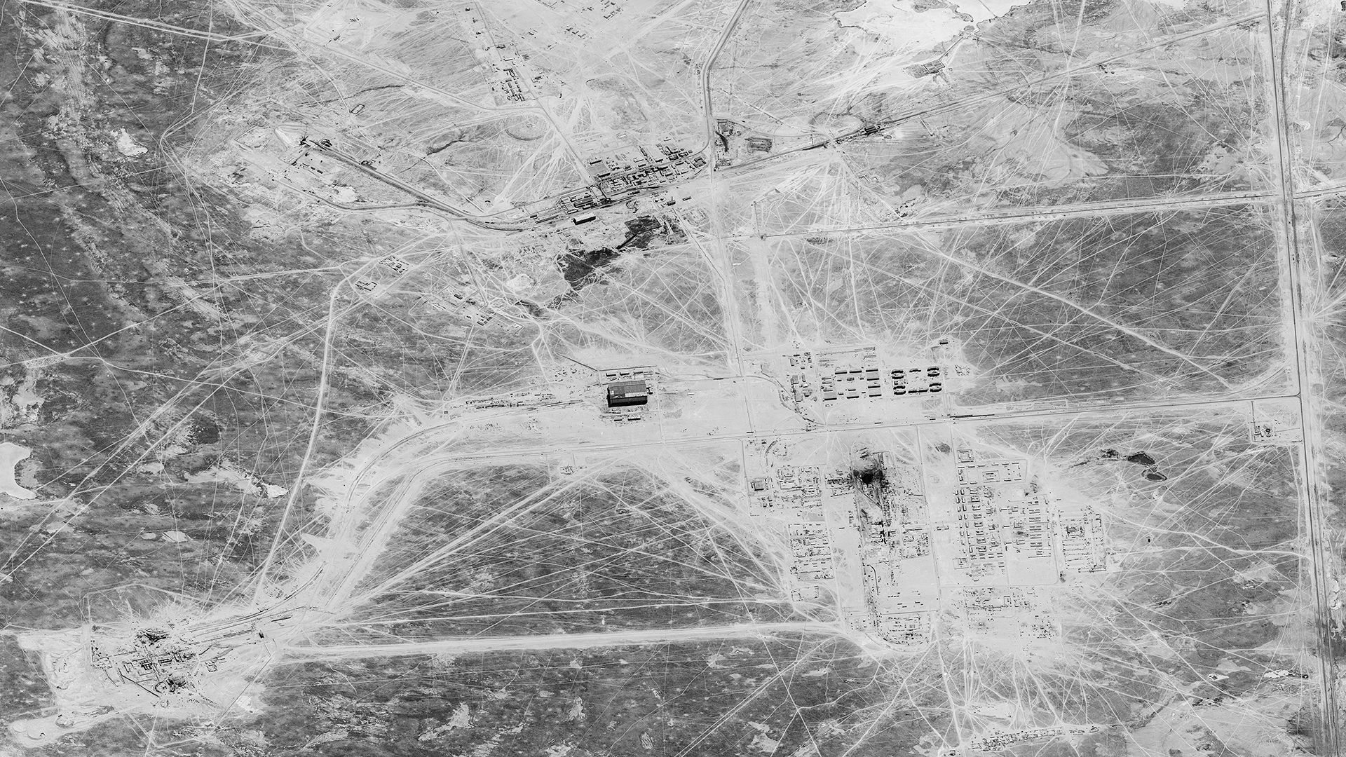
The USGS’s EarthExplorer is probably one of my favourite imagery resources that exists. The archives are so incredibly rich and full of amazing imagery. So much in fact that not all of it has been uploaded yet! Ranging from historic and current day aerial imagery, to declassified spy satellite imagery, digital elevation data, land cover maps and more… There is soo much to explore.
You can explore these archives for free, but to download any files you do need to create a free account. But trust me… it’s worth it.

To start, zoom to your area of interest and use the tools to draw your box, I usually just select the ‘Use Map’ option which selects the entire area shown on your screen. You can select a date range if you want to, but I’ll leave it blank for this example so we get more results. Next select ‘Data Sets’ to open up your options.
Now, here I’d recommend selecting ‘Use Dataset Prefilter’ as this will remove any options that aren’t available in your chosen location. Now you can find the data that you’re after. If you’re unsure what any of the options are, just select the ‘info’ button and it’ll open a page with an explanation about that dataset. Once your dataset is selected you can press the ‘Results’ button to see what’s available.
Once your results load can see their footprints, information about the image, download the full image for free, and if the image isn’t available to download you can request it to be scanned, however be aware that this does cost $30 USD per image.
There is so much more to explore on this site. Maybe I’ll have to do an in-depth post in the future.
Soar
**Full transparency:** I do some contract work with the team at Soar, but I’ve included them here because I genuinely use the platform for my projects. They didn’t ask me to write this, and they haven’t seen it before publication. These are my own unbiased thoughts.
Soar is a unique platform largely centered around a community based map platform where users can upload their maps to share with the world for free. Think along the lines of YouTube for maps. However Soar is much more than just maps. It’s also a great place to quickly view free satellite imagery from the Landsat and Sentinel satellites. It’s great for mobile users too! All you need is a free account.
 and desktop (right)")
Simply click on the ‘Satellite’ tab, zoom to the location you want to view and select it. You’ll automatically be shown the latest Sentinel-2 captures, but you can also toggle that to images from Landsat 8 & 9. Soar also had a wide array of scripts so you can view the imagery with different ‘filters’ applied, so to speak. These can help you view things like fires, vegetation, etc.
Once you’re viewing an image you have the option to use a simple transparency slider, download, share, create a ‘Stoary’ (desktop only) or a GIF (desktop only) between different images.
Copernicus Browser
Next up is ESA’s Copernicus Browser. This is my personal favourite site to browse datasets from the Sentinel satellites. You can use the browser for free and without an account, but there are some features that do require you to sign up for a free account.
It’s quite simple to use. Just find the location you want to look at. Select the dataset that you’d like to use. If you’re not quite sure what every option is, there are helpful info pop-ups you can click on and get a quick explanation of what the imagery is. For me personally, I like using the Sentinel-2 datasets. Select that and you then have the ability to change the max cloud coverage that you want to allow, and of course the time range you want to search within. And then hit ‘Search’.
Now you get your results. Choose the option you’re after and that is ideally mostly cloud free. Now you can see the tiles quickly load into place and you can interact with the imagery. This makes the process so easy. You can view and interact with the imagery without having to download a bulky file and load it into a viewer. It’s all right there in your browser!

You also have extra processing options such as false colour infrared, NDVI, and more. You also have many more options such as the ability to pin the current imagery for future reference, an editing tab to tweak the images in the browser, a feature that allows you to compare the imagery with another image of your choice, and even the ability to download full tiles from these datasets.
On the right side of the screen, you have the ability to draw polygons, lines, points, measure, timelapse, 3D viewer, and more.
I could do a whole post going into depth on Copernicus Browser alone, but I’ll leave it here for now.
Others
There are many more sites I wanted to discuss here but it would just take forever however, I have a page dedicated to resources (https://www.spacefromspace.com/resources) that you can use which includes many sources of free and paid imagery!
And remember, when using images from any of the sites I’ve mentioned in this post, please remember to credit the imagery as the platform requests. It’s the least we can do when using amazing free data and it will keep everyone happy.