In 2025, the amount of historical declassified spy satellite images in the SpaceFromSpace archive nearly doubled. These frames from CORONA, GAMBIT, HEXAGON, and other programs shed light on many locations from 1960 to 1984. Below are a few of my top picks that you might find interesting.
R-16 Missiles in Yurya, USSR
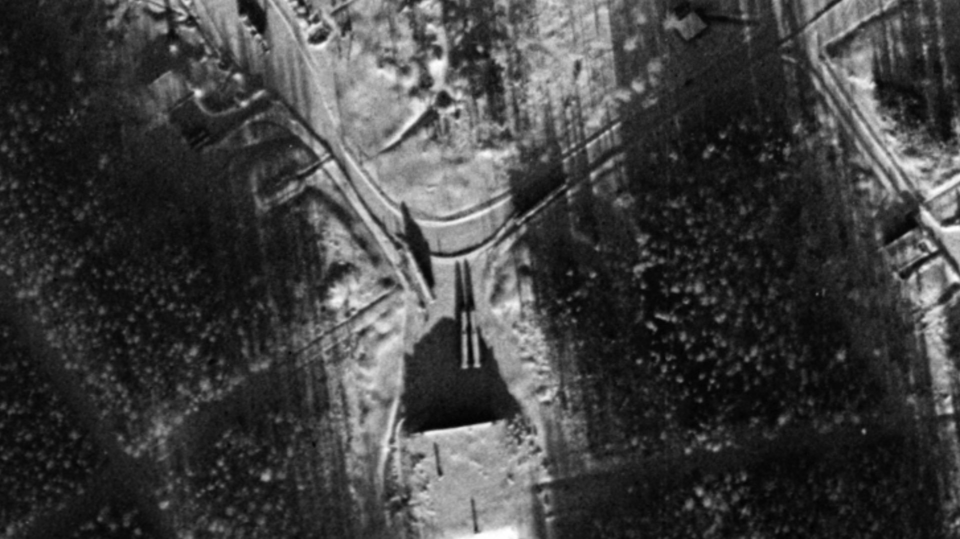
This image in particular is a great example of a KH-7 GAMBIT satellite doing what it was built to do. On January 21, 1966, KH-7 Mission 4024 captured a frame over Yurya ICBM Complex, about 55km north of Kirov, and hit the jackpot. The exposure captured at least 9 Soviet R-16/SS-7 ICBMs out in the open. Some just outside of their hangars, one horizontal on a launch pad. You can read further on this imagery in the following article written by Dwayne A. Day: https://thespacereview.com/article/5082/1
View the full image: https://spacefromspace.com/declassified-satellite-images/yurya-russia-19660121-dzb00402400025h001001/
Possible Energia Rocket Tanks
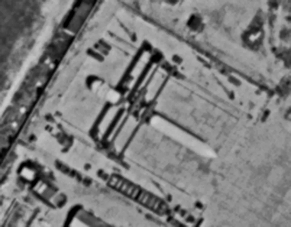
In the late 1970s, the Soviet Union had plans a new heavy lift rocket variant following little success with its N1 moon rockets. The new vehicle, Energia, would be capable of carrying a side mounted ‘Space Shuttle’ equivalent, but also flying on its own. A large project like this is highly visible in multiple ways via reconnaissance satellites and spotting large rocket fuel tanks is one of them.
After digging through the archives, we found some great images of what we believe to be Energia tanks (possibly test articles) at Zhukovsky/Ramenskoye, an airbase outside of Moscow. Why at an airbase? Since the large tanks had a diameter of nearly 8-meters, the Soviets decided to mount them on top of an M-4 transport aircraft and ferry the items out to Baikonur Cosmodrome.
Read further on this topic in the following article by Dwayne A. Day: https://thespacereview.com/article/4939/1
View the full images:
5 Jun 1982: https://spacefromspace.com/declassified-satellite-images/ramenskoye-airport-russia-19820605-d3c1217-100265a001/ 14 Jul 1982: https://spacefromspace.com/declassified-satellite-images/ramenskoye-airport-russia-19820714-d3c1217-200660a025
The Yellow Fleet, Trapped in the Suez Canal
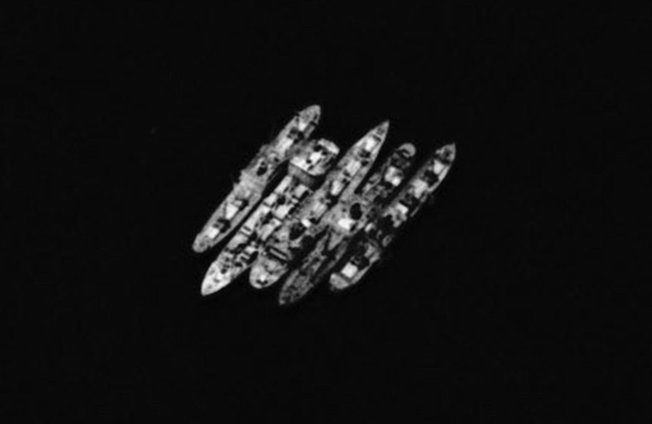
In 1967, Israel and Egypt clashed in the Six-Day War. During the war, Egypt sealed off the Suez Canal on both ends. 15 ships which were heading north through the canal were forced to wait in the Great Bitter Lake, the widest area of the Suez Canal. These stranded ships became the Yellow Fleet.
The ships remained standard in the Great Bitter Lake until 1975. Over this time, dozens of U.S. spy satellites flew missions over the area and captured the fleet during the eight year period. Read more about this topic in an article by Dwayne A. Day: https://thespacereview.com/article/5249/1
View the full image: https://spacefromspace.com/declassified-satellite-images/great-bitter-lake-egypt-19730805-d3c1206-200231a008/
The St. Louis Gateway Arch Rises
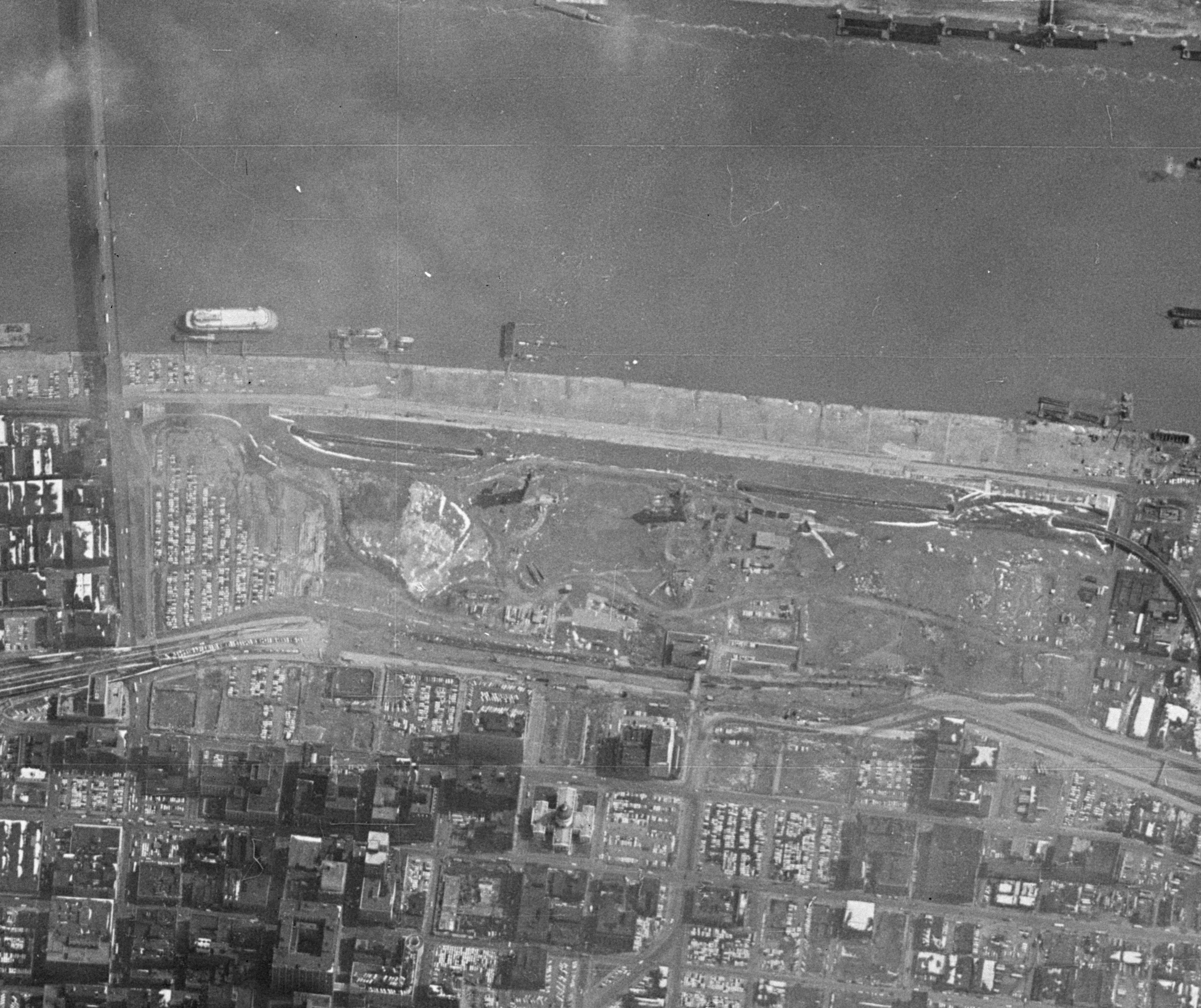
The iconic 192-meter-tall Gateway Arch located in St. Louis, Missouri, United States, began construction in February 1963, just five months before the first KH-7 GAMBIT spy satellite was launched. Just over a year into construction, the sixth KH-7 mission, 4006, captured the structure rising out of the ground on March 12, 1964.
View the full image: https://spacefromspace.com/declassified-satellite-images/st-louis-missouri-19640312-dzb00400600015h009001/
Aftermath of the 1980 Mount St. Helens Eruption
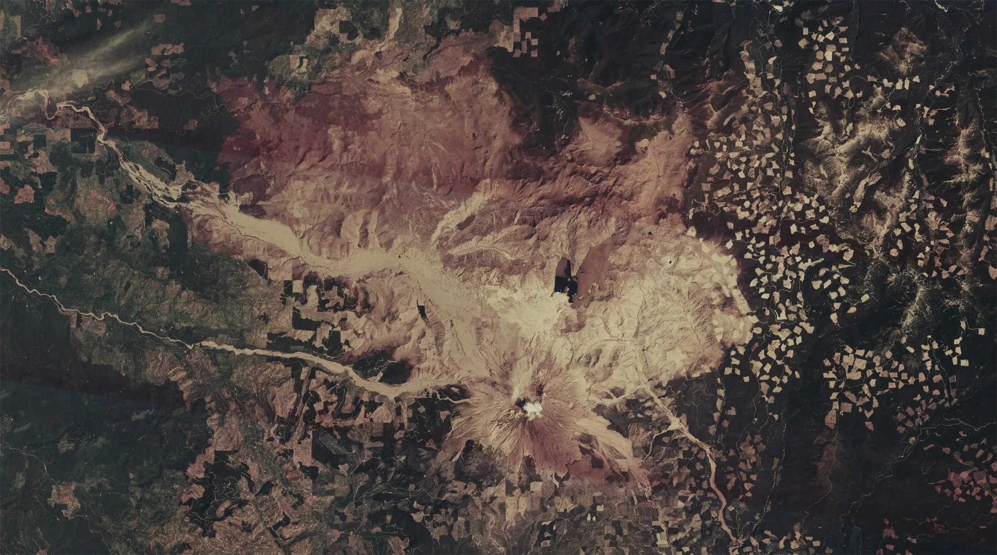
Taking place on May 18, 1980, the eruption of Mount St. Helens was one of the most notable volcanic eruptions in modern history. The volcano was imaged many times by spy satellites in the 1960s, 70s, and 80s, but the most notable imagery may be that taken by a KH-9 HEXAGON satellite on June 30, 1980. The photographs, taken on colour film show the volcano and its surroundings just about six weeks after the eruption.
View the full image: https://spacefromspace.com/declassified-satellite-images/mount-st-helens-usa-19800630-d3c1216-100112a003/
The 1975 Banqiao Dam Failure
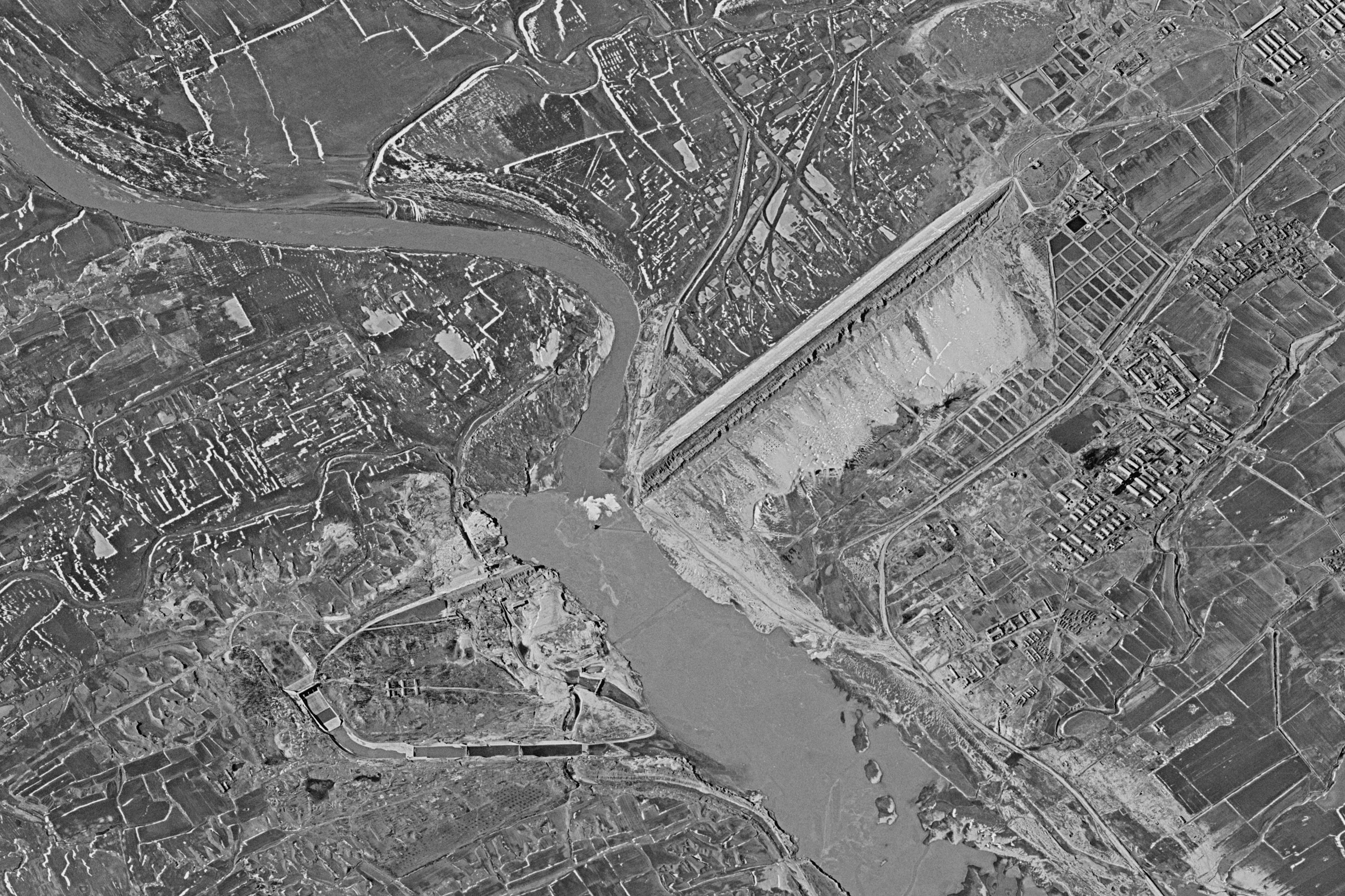
In August 1975, Typhoon Nina made landfall over southeastern China. The extremely heavy rainfall led to the collapse of 62 dams throughout the province of Henan. The most notable of these dam collapses was Banqiao Dam. The flood following the dam’s collapse is recorded as the third-deadliest flood in history with an estimated death tool between 26,000 and 240,000, and the destruction of up to 6.8 million houses.
A KH-9 HEXAGON satellite captured the aftermath in the region four months later on December 17. The break in the dam and the following path of destruction is clearly visible.
View the full image: https://spacefromspace.com/declassified-satellite-images/zhumadian-china-19751217-d3c1211-100084a042/
Plane taking off in Zhigansk, Russia
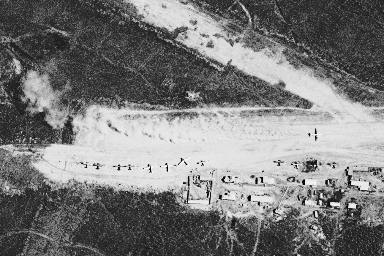
To end on a lighter note, this image taken by a KH-7 GAMBIT satellite on June 9, 1966 shows are airplane seemingly taking off from a small dirt airfield to the north of Zhigansk, USSR. The plane, nearly halfway down the runway is seen leaving behind a large trail of dust and dirt being kicked up by the vehicles engines. Spotting planes in motion in satellite images is always fun and this one definitely tops the list for 2025.
View the full image: https://spacefromspace.com/declassified-satellite-images/zhigansk-russia-19660609-dzb00402900086h002001/