Blogs & Articles
Articles, guides, and analysis on declassified satellite imagery, spaceports, and remote sensing. Includes external articles using images sourced via SpaceFromSpace.
Interested in writing a story using imagery from the archive, or have an idea for a collaboration? Get in touch.
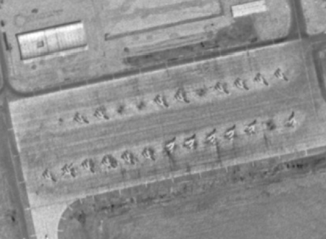
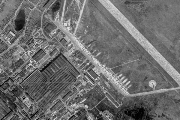
The last days of the Persian Cats
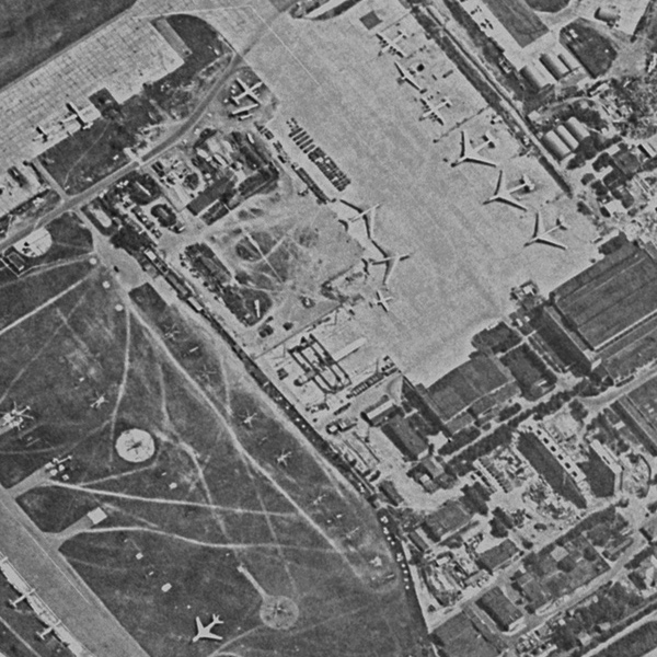
In May 1978, an American HEXAGON reconnaissance satellite overflew the major Iranian airbase at Isfahan and photographed many of the brand-new Iranian aircraft parked on the ramp. Forty-eight years later...
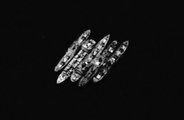
Yellow Fleets: stranded ships in Suez and the Persian Gulf
For eight years following the Six-Day War between Israel and Egypt in 1967, 15 merchant ships were trapped in the Suez Canal. Recently declassified satellite photos showing the trapped ships...
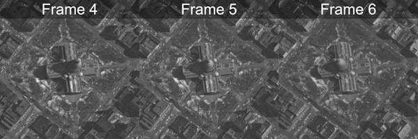
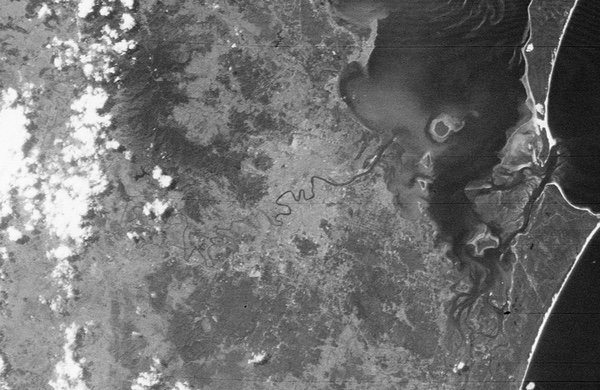
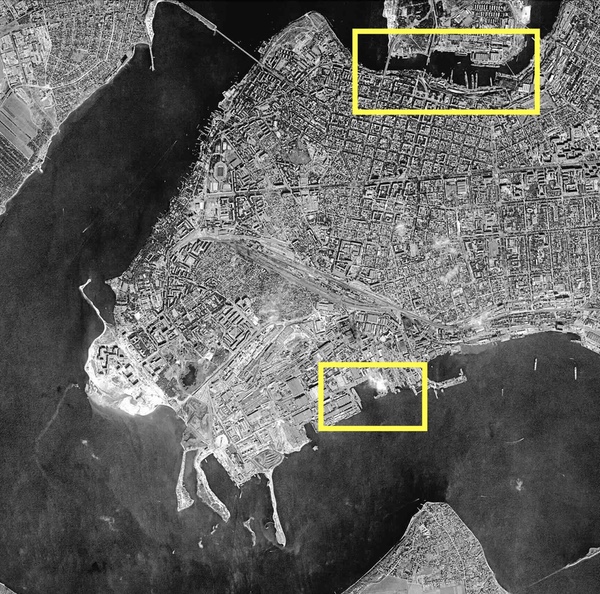
Hello, Madison! A top-secret Cold War mission over Wisconsin’s capital
The GAMBIT reconnaissance satellite program was started in 1960 to obtain higher-resolution photos of targets in the Soviet Union, specifically ballistic missiles. GAMBIT was designed to enable positive identification of targets and...
Where to Get Historical Satellite Images
Finding historical satellite images is surprisingly straightforward once you know where to look. The hard part is knowing where to start.
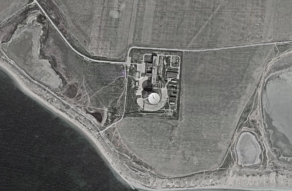
Declassified Spy Satellite Images of Cold War Nuclear Test Sites
Declassified CORONA and GAMBIT spy satellite imagery captured many major Cold War nuclear test sites, Lop Nur, Semipalatinsk, Novaya Zemlya, and more. Here's what the satellites saw, and when.
Satellite Reconnaissance During the Cold War
The first CORONA system used a panoramic camera that swept a lens over a long, thin piece of film, exposing a large amount of territory in each sweep. Test launches began in early 1959 from a military base on the California coast.
Big little rocket: The N1 Moon rocket and the cognitive dissonance of spy satellite photography
Throughout the 1960s, American reconnaissance satellites overflew the sprawling Soviet launch complex in Kazakhstan, photographing construction and equipment, looking for changes...
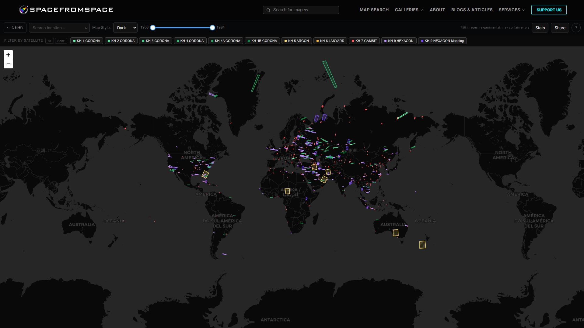
Declassified Cold War Spy Satellite Images, Interactive and Free to Browse
SpaceFromSpace has a growing archive of interactive, historical Cold War spy satellite images. Browse declassified satellite images from CORONA, GAMBIT, and HEXAGON on an interactive map.
The 'Open Data' Directory: List of Open Satellite Data 2026
Open data should be standard for every satellite imagery company in 2026, but few have properly gone ahead with it. This short guide walks you through the best options.
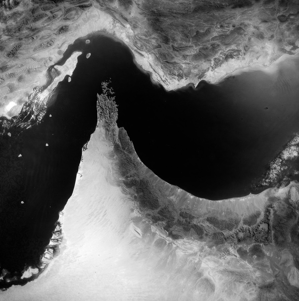
Breaking dishes: the space facility at Yevpatoriya
Using declassified imagery and reports to look at Soviet communication sites in Crimea.
4 Places Cold War Era Spy Satellites Photographed That You Won't Recognise Today
Declassified CORONA and HEXAGON spy satellite imagery from the 1960s and 70s shows a world almost unrecognisable compared to today. Here are four of the most striking before-and-after locations in our archive.
Fascinating Declassified Satellite Images from the Archive: 2025
An overview covering just a few amazing declassified spy satellite images uncovered in 2025 by SpaceFromSpace.

Where to Get Free Satellite Imagery in 2026
The best free sources of satellite imagery in 2026. No need to waste time doing through complicated sales processes. It's now easier than ever!
The Backfire bomber controversy
The article explores the Cold War intelligence debate over the Soviet Tu-22M Backfire bomber, highlighting how declassified CORONA and HEXAGON satellite imagery allowed analysts to track the aircraft from its first prototypes to its final deployment.
Mapping the dark side of the world (part 3): Replacing ARGON, the SAMOS E-4, and mapping the Moon
Throughout the early 1960s, there was a constant bureaucratic turf battle over which service would control satellite mapping. While ARGON was in development and beginning launches, the Air Force was trying to produce a follow-on system, in the hopes that it would succeed ARGON...
Mapping the dark side of the world (part 2): supplementing, and supplanting, the ARGON geodetic satellite program
In February and April 1961, the first two KH-5 ARGON mapping satellite missions were unsuccessful due to reentry malfunctions. The next two missions, in June and July, suffered launch failures...
Mapping the dark side of the world (part 1): The KH-5 ARGON geodetic satellite
The US Air Force began studying the possible uses of a satellite for military purposes in 1946. At a time when space was no more than a Flash Gordon fantasy...
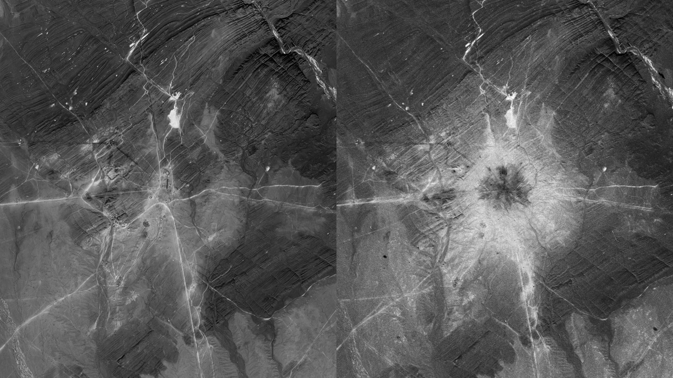
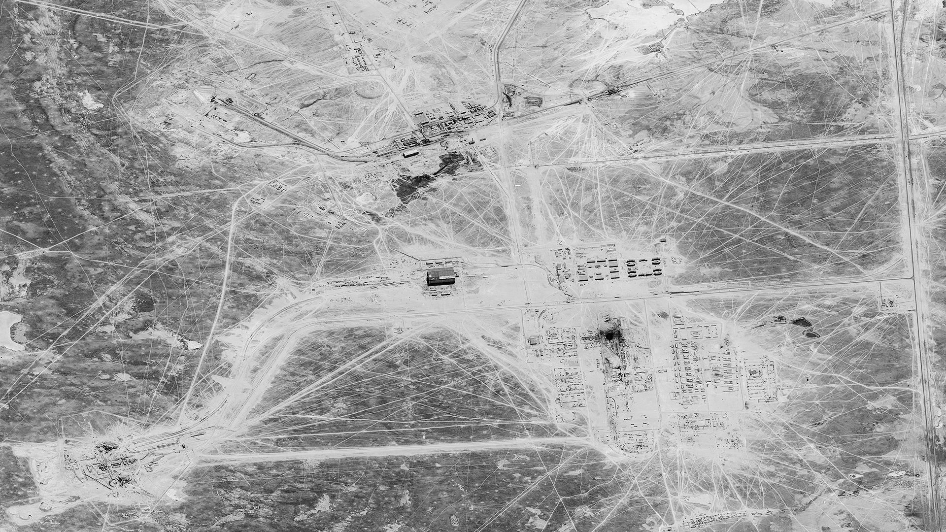
Unleashing hell: the R-16 ICBM
In early 1966, an American reconnaissance satellite overflew the Soviet Union and hit the jackpot: during several passes over the Yurya ICBM complex, it captured Soviet SS-7 ICBMs sitting outside...
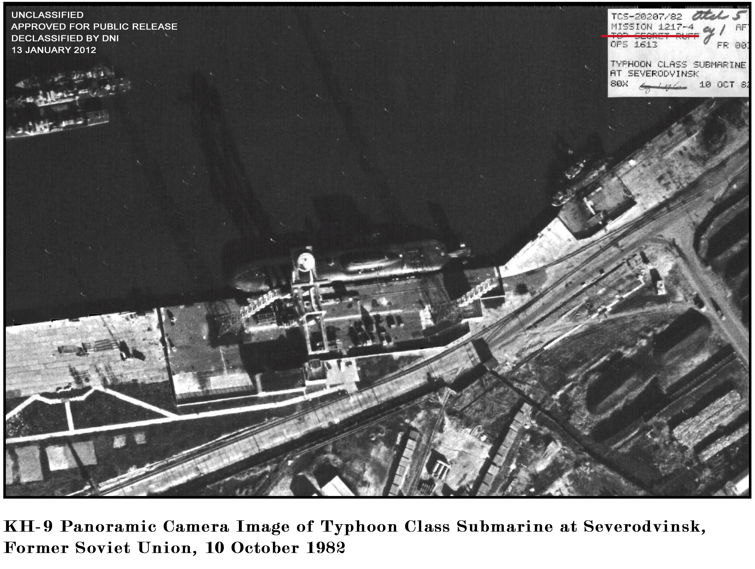
Carriers and battleships from space (part 3): The Mighty O and the Mighty Mo
In summer 1980, an American reconnaissance satellite flew over the Soviet Union’s Severodvinsk shipyard and for the first time photographed a new, large nuclear-powered cruise missile submarine...
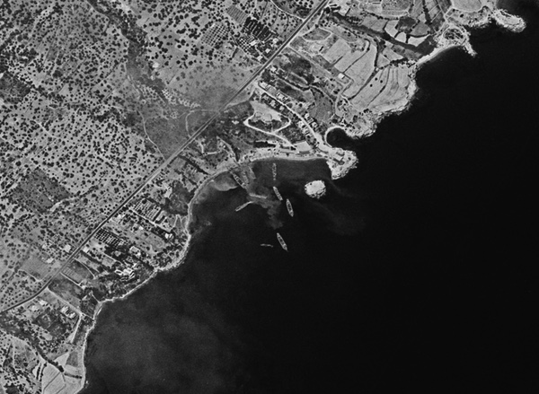
Flashpoint Cyprus 1974: Cold War satellite reconnaissance and peripheral wars
Using declassified spy satellite images to look back at the 1974 invasion of Cyprus.
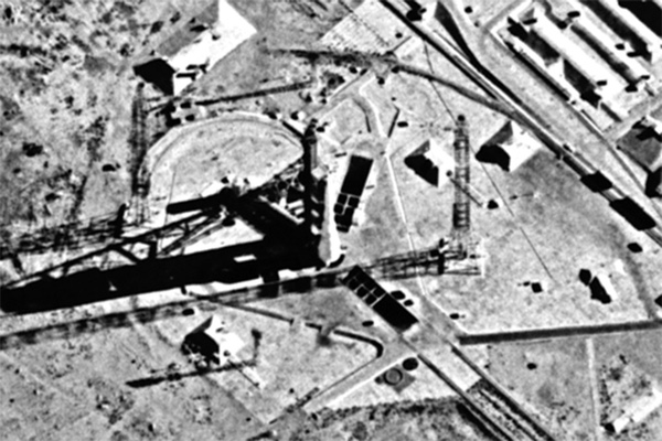
Power lifting: Cold War satellite reconnaissance and the Buran space shuttle
The construction and modification of facilities and aircraft for the soviet space shuttle tracked using declassified spy satellite imagery.
How to Download Declassified Spy Satellite Images For Free
A quick guide on how to download historic declassified spy satellite images from the USGS website.
Satellite reconnaissance and the Falklands War
Using declassified KH-9 HEXAGON spy satellite images to view scenes of the Falklands War in 1982.
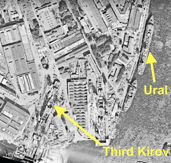
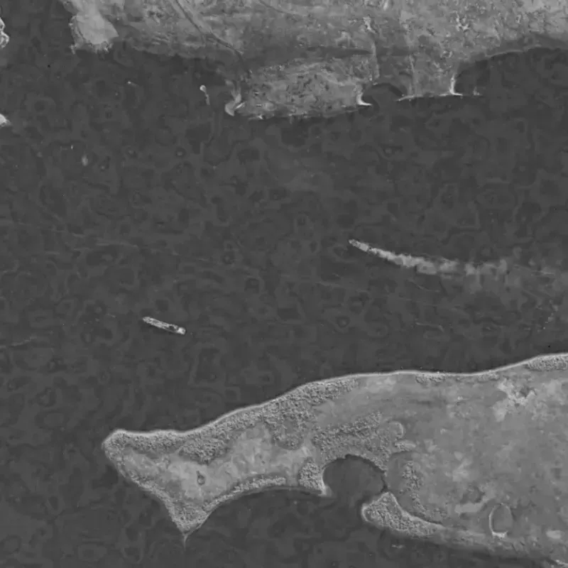
HEXAGON vs. Kirov: American satellite reconnaissance and the Soviet Union’s most powerful warship
Using declassified KH-9 HEXAGON spy satellite images to track the construction of Soviet warships, and more.

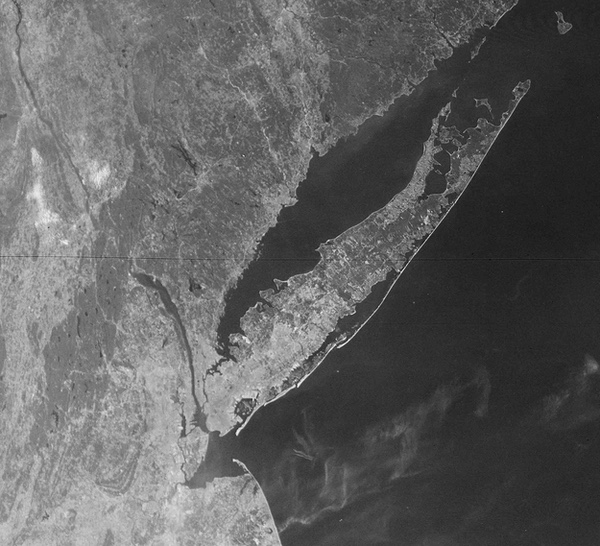
Declassified Spy Satellite Images of Famous Landmarks
Ever wondered what famous places looked like from space during the Cold War? This blog shares some images of many famous landmarks all over the world.
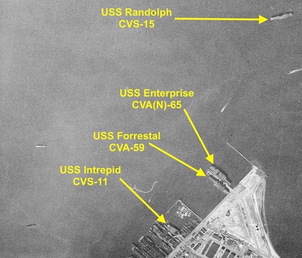
Carriers from space (part 2): Contemporary use of satellite imagery for open source intelligence
Part 2 of Dwayne's previous article on using satellite images to observe and track aircraft carriers, this time with more modern imaging satellites.
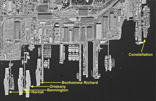
Carriers from space (part 1)
Following some back and forth discussion and sleuthing on the NASASpaceflight forums Dwayne wrote this fascinating article going over some history of aircraft carriers that were imaged by US spy satellites.
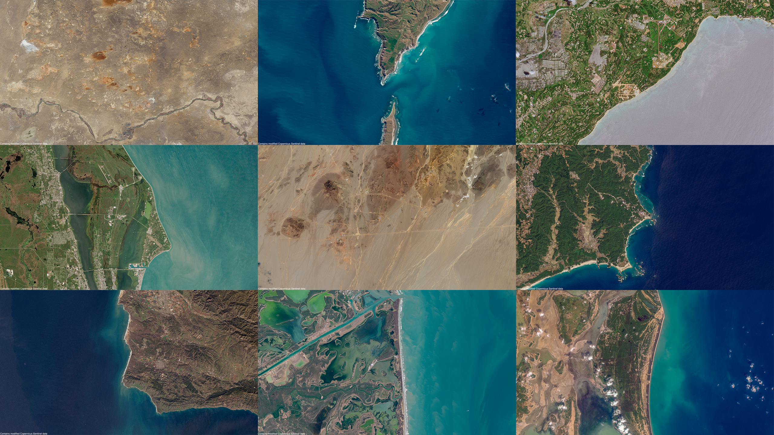
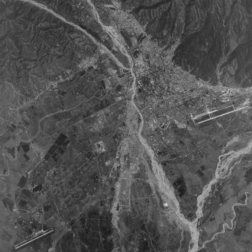
Satellite Images of the World's Spaceports
An overview of serveral key spaceports arpund the world using stunning satellite imagery taken by the Sentinel-2 satellites.